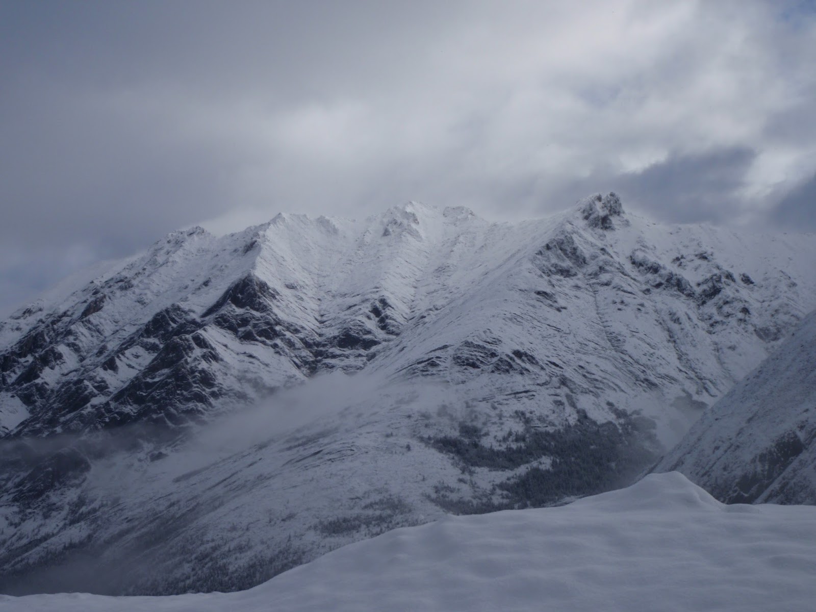
South Schlee (GR 388157) is a minor summit between the
incredibly beautiful and massive Elpoca Mountain and the unofficially named
summit of Mount Schlee (GR 385168). Located in the Opal
Range along the boundary of the Elbow-Sheep Wildland
Provincial Park and Peter Lougheed Provincial Park this peak does not have an
official name and, until recently, there was no record of an ascent of this
significant mountain. This singularly prominent blocky summit reaches an elevation of 2820
metres (9,250 feet) and is the twentieth highest summit in the Opal Range (I have
identified 35 significant highpoints in the range).
I applied the name of “South Schlee” to this summit simply
because it is immediately south of "Mount Schlee". The
summit of South Schlee is about 1.2 kilometre north of Elpoca Mountain (3029 m)
and shared col between is approximately at 2680 metres; giving South Schlee a
prominence of 140 metres from this col. There is about 100 metres of prominence
between Mt. Schlee and South Schlee, and isolation of about 1.2 km between the
two summits.
 |
| "South Schlee" in the centre, Elpoca Mtn. on the left, "Mt. Schlee" on the right. |
 |
| South Schlee |
On Saturday, September 17, 2016, with a late afternoon start,
with my new friend, Scott Berry from California, we headed towards
Piper Pass (immediately north of Elbow Lake) to set up a camp for some
exploration and climbing in the southern Opal Range. We camped at tree line
near the approach of Mount Schlee. After a big sleep and a nice casual
start Sunday morning, lots of breakfast and coffee, we head up the easy
east slopes of South Schlee to gain the long North Ridge. Easy route
finding and easy scrambling brings one to a low point horizontally very near
the summit block of South Schlee on the North Ridge.
South
Schlee could be scrambled by the North Ridge direct by a competent scrambler,
but it goes at about 5.2 with extreme exposure; we descended the full North
Ridge from the summit block. On our ascent, from the low point on the ridge
north of the summit, a deep notch on the upper ridge looks very difficult
(turns out to be easy left of the crest). Fearing a difficult rock ascent, we
dropped from the low point on the ridge and followed easy scree slopes south,
skirting the summit cliffs until directly below the deep notch. From there we
climbed a steep gully, first with scrambling, then a 5.3 ish step, then we got
out the rope. From the belay we climbed about 30 metres of 5.6 rock, difficult
since much of it was covered in verglas. My friend Scott lead this pitch.
We only had one hammer, Scott placed a piton at the crux section, which I could
not remove, so the piton is left as a relic on the mountain.
After
the 30 metres of gully, about 10 metres of loose scree bring one to the deep
notch. Turned out the overhang of the notch could be avoided by scrambling a
loose and steep gully to climber’s left of the notch overhang, difficult
scrambling at the start of the gully. Once up the gully and on the final broad
summit ridge, it is a walk to the summit. We found no cairn or any trace
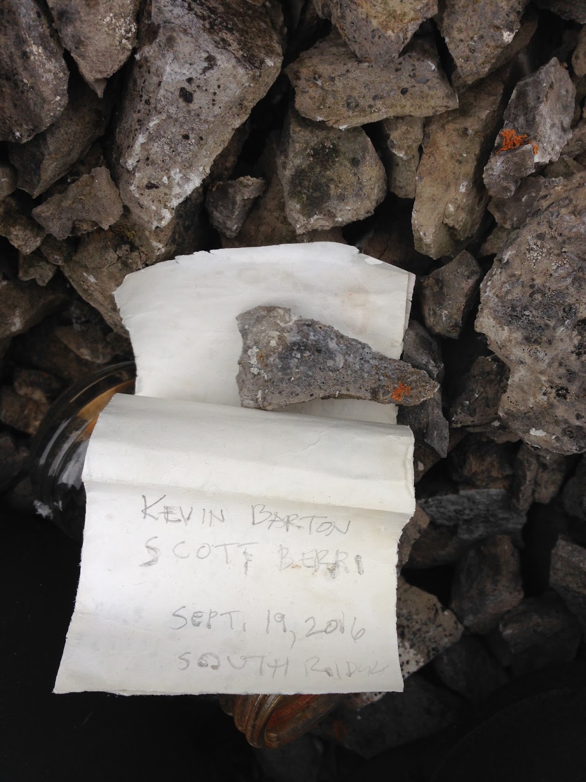
of previous passage. I built a cairn and left a register. First recorded
ascent of this cool peak, Sunday, September 18, 2016.
 |
| Approaching low point on North Ridge before summit block. |
 |
| Over the low point on easy scree slopes on the West Face, heading the to the gully. |
 |
| Lower section of gully. |
 |
| Start of roped climbing in gully. |
 |
| Crux of gully section. |
 |
| Looking down to crux; piton left for the ages... |
 |
| Route beta for summit block from north ridge approach. |
 |
| Looking down the North Ridge, just above the "scary notch" section. |
We descended the North Ridge, just after
the deep notch, the ridge gets super narrow, with extreme exposure to the east,
we bum shuttled on the knife edged ridge without a rope. Continued descending
easy ridge (15m) to a short traverse section that had two towers, these small
towers were climbed directly, I lead across this sections, maybe 15 metres with
easy climbing (5.2 ish), but exposed bumps, got good cams along the towers.
Once across these two features, steep traverse on scree, then back to the
ridge crest and scrambling back to the low point, and easy slopes back to Piper
Creek and our camp.
 |
| Nearing summit, no cairn on top. |
 |
| Scott M. Berry on the summit of South Schlee. |
 |
| Kevin Barton and Scott Berry on the summit South Schlee. |
 |
| New summit registry left on the summit. |
 |
| New summit cairn. |
 |
| Leaving the summit. |
 |
| Scott seconding the 5.2 towers on descent. |
 |
| Scramble back to the easy North Ridge. |