Thursday, December 25, 2014

Solid Cold - WI3, 30m


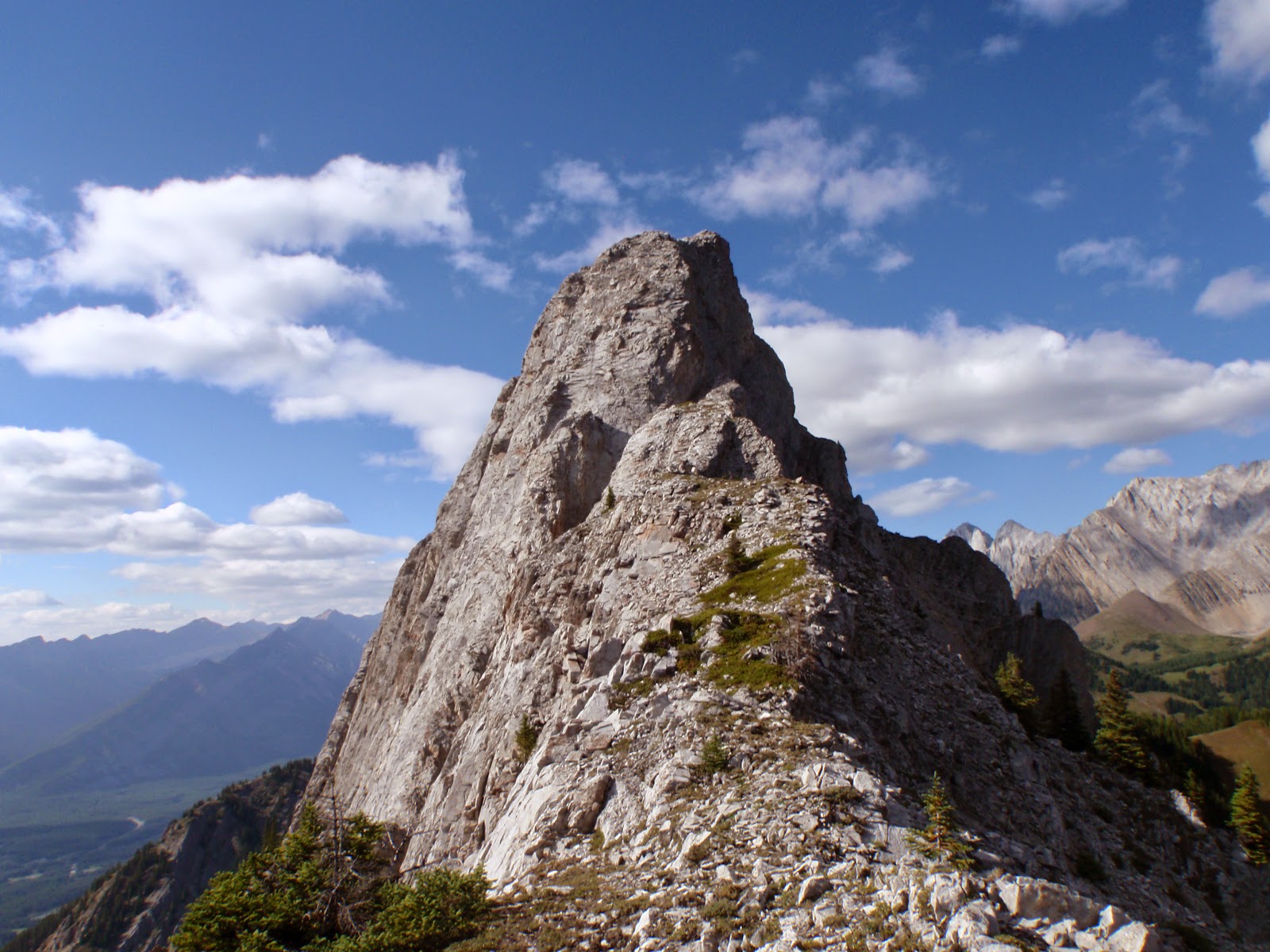
Shortest day of the year and we had a big change of plans throughout the day. Originally three of us were heading to the Ghost, likely to solo THOS and climb some of the upper bowl pitches, but JW’s truck had a mechanical on the way, luckily while still on pavement; we limped back to town. John and I headed to K-country to salvage the day, most crags looked busy; I had long wondered about Solid Cold, so we went for it.

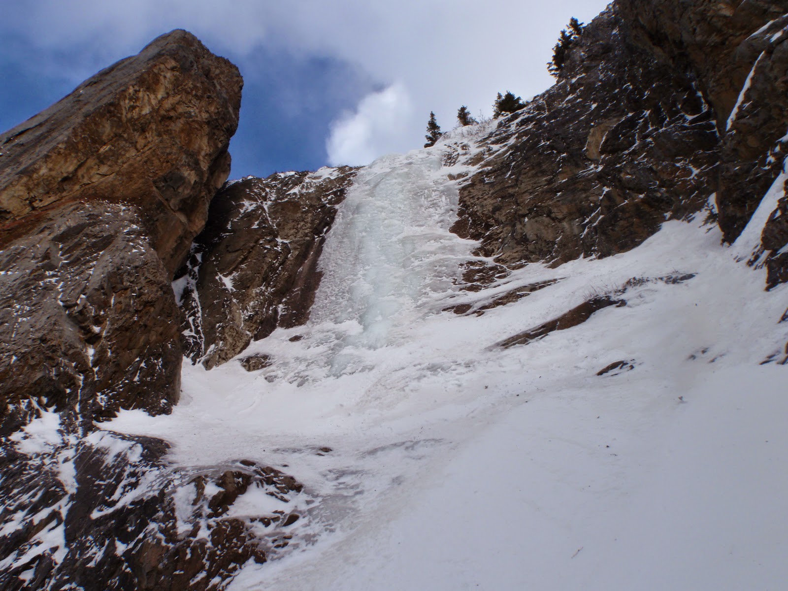
The main ice flow is hidden behind a rock buttress, the left hand  side  of the "y"

Park at Fortress Junction gas station, head up South Opal Ridge trail. The biggest flow is obvious from the parking lot, but as you gain elevation, the climb disappears behind a large rock rib. The guidebook mentions dropping into the creek before the cliff that hold the climb, I agree, less elevation gain. Our descent into the creek was into a narrow gully, that quickly broadened into a scree slope. This descent into the creek was just before the big step, grey limestone broad buttress, that tops out at the elevation at the top of ice pitch.  Once in the creek bed, head directly up the creek, but on the left side, and paid careful attention to the snow pack. Nearing the climb ice filled the gully starting below a rock rib, we were lazy about putting on crampons and struggled to the rib on dodgy feet, scrambled up the icy rib, then finally put on the poons.

Above the rock rib we don crampons. John having a good time.

Long hike in, solid two hours; and it turned out the real climbing was only 30m of fun WI3, without considering about 100m of WI2 approach ice. Quick lead up by myself, about 30m of steepish WI3, with poor to good quality ice; I am pretty sure we are the first party up this route this year(s).

Kevin leading the short pitch.
(Photo by John B.)

Then John and I did a few TR laps on the thin edges of the flow, centre of the climb was okay, but overall the ice was sun affected and not well attached. The climb felt stiff for WI3, but it was all virgin ice, and poor quality, probably why it felt stiffer. On descent we headed straight down the creek, worked out well, only one hour out. Should note that the gully above and below the climb is usually wind loaded, this route is only recommended with low or no snow in the gully. If you don’t mind an uphill workout, this is a good spot for some easy ice, overall a fun day, with low commitment.


                          The real climbing. About 30m of steepish WI3, poor to good quality ice.

Tuesday, December 9, 2014

Tasting Fear - WI5, 30m


After a few attempts to get a couple of first ascents on ice that didn't work due to snow and ice conditions, final got out for some ice cragging.  Meet up with Ian G. for a fun day of playing on top rope on the short, but steep ice route, Tasting Fear. This short pumpy grade 5 route is located way up Galatea Creek. I had to break trail through boot top snow for most of the approach, which seemed pretty long.  Cool little waterfall and bay in the canyon where the climb is located. Climbed up easy mixed terrain left of the pillar then set up a top rope and enjoyed a few steep laps.


Great fun to be on ice again.  

Monday, September 22, 2014

GR 368155 ('Opoca Peak') - South Ridge Attempt 5.8+ R


Part of my Opal 35 Projectand also since it is a cool little peak, Laurie and I set off to attempt the South Ridge of GR 368155 ’Opoca Peak’ in the Opal Range on August 26 after work. This little peak is between Mt. Wintour to the north and Gap Mtn. to the south and has a large vertical summit block. I applied the name of Opoca Peak since it is along the divide between Opal and Elpoca Creeks.  I have been most of the way up the South Ridge of Opoca Peak with Vern, Eric and Steven back in January 2014. We turned around because of the lateness of the day, but we never got a good look at the start of the vertical ridge section.
Looking up South Ridge
I was hopeful that the ridge was in the 5.5 to 5.7 range, well it turned out to be tougher. The broad ridge ends at an overhanging wall, not too tall, maybe 7 or 8 metres, but overhanging, blank for rock protection and loose. Around the prow of the ridge on the east aspect, I found a loose and chossy chimney that was about 5.6 or 5.7, but the left side of the chimney was incredibly loose and likely would have fallen off if I used it as a hold. This section also had no protection. I climbed up about 5 metres and bailed due to the looseness of the rock. Back to the overhang.
5.7 death choss chimney
The overhang did have a nice foot ledge traverse from the lowest section towards the steepest and tallest section of the overhang. This traverse was a pumpy 5.8, with a huge, powerful move required to transition from the overhang to the lower angled rock on the lower angled section of the ridge (5.8+ R).  This traverse and the big move up were not protectable with your feet now about 5 metres above the nasty crash zone. The move up into easy terrain looked incredibly loose. I tried for well over an hour to get a piton into the rock, but the rock was too either too tight or too loose.  Not wanting to risk the big move without protection, we bailed. We searched for alternative routes for about an hour, no luck, so we turn our tails and headed home.  I will be back for the North Ridge/East Face route one day soon.

5.8+ R lower section

Tuesday, September 2, 2014

Mount Fisher - Scramble

Had hopes for some big mountains in the Rockies, but unstable weather was hanging around in mid August, so I ended up with a fun and easy scramble to end my holiday. I meet up with Steven Song and we decided the best chance for fair weather was on the western side of the Southern Rockies; thus our objective became Mount Fisher.

Mt. Fisher is the landmark icon in the southern Columbia Valley near Cranbrook and Kimberly, British Columbia. This shapely mountain towers above the surrounding peaks and is a very popular scramble for locals. It is reported that the Stanley Cup (NHL champion cup) has been to the summit of Mt. Fisher twice.


The crux of the day is finding the right logging road to access the trailhead. Rough road for 8 km makes the start of the steep hike. A short steep hike takes one to a beautiful sub-alpine valley and onto a steep col. Great scenery once above tree line. Mostly an easy slog to the summit, with one or two hands on and exposed scramble section just below the pointed summit. We had limited views, but did get a sneak a peek at the impressive Mt. Washburn, high on my list now.

Good choice for a day of very unstable weather. Great to bag this beautiful little peak, fun day out.

Friday, August 22, 2014

GR 376159 ('East Opoca ') - Scramble


Thursday August 14 Raff and I had hoped the weather would hold and we were keen to attempt Mt. Jerram. On the hike up Opal Creek, the clouds got thicker and thicker and lower and lower, so we turned our attention to the low summit of Opoca Peak (GR 368155). Opoca Peak, thusly named since it divides Opal and Elpoca Creeks, is a short, but tough technical climb with zero beta.


Mt. Jerram (l) and North and South Cat's Ears (r)


We were hoping to ascend quickly as we knew the rain would come soon. We slogged up to the col between Opoca Peak and East Opoca, hiked to intersection of this col and the north ridge of Opoca Peak. Searched a variety of locations along the steep face for the best line, geared up, rock shoes on, then the hard rain started. We removed our rock gear and decided to hike in the pouring rain to the low summit of East Opoca (GR 376159), about 1 kilometre to the east.


View to East Opoca


Fun and scenic hike considering the awful weather. The driving rain stopped as we reached this little summit (2450m).  We did the quick hike over to the slightly lower eastern highpoint as well. A fun hike with great views with lots of wet weather.

Tuesday, August 12, 2014

Mount Nelson - Scramble

Meet up with TJ and Meg the day after Barber Rock for a classic Columbia Valley scramble; Mount Nelson. A very prominent peak from the Invermere area. Mt. Nelson reaches an impressive height of 3315 metres and has a striking summit block. This peak is highly sought by locals and often is the pinnacle of some locals alpine experiences. Actually it is a moderate (Class 3) scramble to a prominent summit with fantastic views of the Rockies and Purcells, including the Bugaboos.

This moderate scramble packs a punch though; about 2000 metres of gain, with the first 600 metres or so on a very steep dirt trail. The hands on scrambling is crazy loose, with a fall presenting terrible consequences. Overall this scramble is a very fine, technically easy, romp to the top of an impressive summit.


Scrambling on summit block.


All approach information and route description is available in the Matt Gunn's excellent trail guide (Hikes Around Invermere & the Columbia River Valley).


Summit shot.


Summit Cross, it is big.

Solitaire (Barbour Rock) - Sport Climbing


The semi famous Barbour Rock. I first learned of this obscure crag in the mid 1990's, it is almost masked in legend; great rock, short approach, diversity of climbs and almost to hot to climb in the summer. 

No published beta, but it can see a lot of traffic. My buddy TJ (who grew up in Invermere) set me up for an awesome day of cragging at this venue. TJ and Meg were at this crag about a week earlier and had fresh beta on the routes. I enjoyed several leads, probably up to sport 5.9 with far spaced bolts. TJ lead a great 10b ish route with a crazy tough overhang crux off the deck, awesome TR for me. 

Appreciate the peek at this great venue with awesome company.


Thursday, July 17, 2014

GR 334290 ('Rocky Peak') West Gully/Face, West Ridge - 5.6, Alpine II

Rocky Peak is a large and looming mountain located near the northern terminus of the Opal Range in Elbow-Sheep Wildland Provincial Park. This peak does not have an official name and, until recently, there was no record, neither written nor shared in pubs, about an ascent of this significant mountain. The sharp summit reaches an elevation of 2915 metres (9,564 feet) and is the sixteenth highest summit in the Opal Range (I have identified 35 significant highpoints in the range). 

I applied the name of “Rocky Peak” to this northern end of the main Opal Range since it is the head waters of Rocky Creek, which is an official watercourse name. This high peak is just south of The Wedge/”MacKay Hills” highpoint, which is the extreme northern end of the Opal Range. Rocky Peak ends the range to the north, but is connected to the south to ‘Mount Denny’ (GR 338277). The summit of Rocky Peak is about 1 kilometre north of Mt. Denny (3000 m) and shared col between is approximately at 2800 metres; giving Rocky Peak a prominence of 115 metres from the col.


The only recorded ascent of this mountain is by me. My long time office friend (L. Kimber) and I (Kevin Barton) ascended the complex and broken West Face via a steep slab gully, then face climbing to the upper summit ridge, West Ridge, on July 2, 2014. We found no cairn or evidence of previous ascents. I built a cairn on the highpoint (northern tower) and left a makeshift summit register, which will probably be eaten by the numerous summit pikas.


Opal Ridge crest


A hike up Opal Ridge provides the most direct approach, but does require about 850 metres of elevation up Opal Ridge, then a descend of 300 metres to Rocky Creek, and of course, the same on the return. This direct approach is about 3 kilometres from the parking area to the base of the west slopes of Rocky Peak. Reach the ridge crest in about 1.5 hours, descend easy east slopes to west slopes of Rocky Peak.

My original goal was to ascend the prominent West Rib on the west side of Rocky Peak, but my partner was concerned about the time required to pitch out this route, and still have time to make the summit. We had a great view of this cool rib as we climbed the easy Class 3 gully beside it. I would guess it mostly goes at 5.6, with the odd harder step, maybe up to 5.7 or 5.8. Looked like a fun route, maybe one day I can return to climb it. 

The West Rib is an obvious landmark on the west side of Rocky Peak. We ascended the low angled gully beside it. Mostly an easy scree hike with the odd short slab section. Efficient and fast height gain up gully. Gully ends in a steep wall, we solo’ed from gully to top of West Rib; first on 30 metres of 5.6 slab, then about 40 metres of 5.5 slab to easy scree to top of rib. From top of rib about 150 metres of steep slab, but solid and great holds (Class 4) lead to the summit ridge. Follow summit ridge to summit, mostly 5.2 or 5.3 on loose ridge, if pitching about 5 rope lengths to summit tower.


My newly built summit cairn seen on descent.


Our descend was down steep scree and slab sections of the South/South West Face. We did run into a steep section that we downclimbed. This section was about 70 metres of steep 5.7/5.8 that was difficult to protect. We did leave 3 pitons (2 pin anchor at the top), 1 piton about 15 metres below the 2 piton anchor. Left pitons since my partner did not have a hammer. Once below this wall, easy Class 3 to scree and back to Rocky Creek drainage. Return over Opal Ridge.

Saturday, June 28, 2014

Aftonroe - 5.7, 220 m (9 pitches)


This relatively new route has become a Bow Valley moderate classic.  The route was pioneered and equipped by two local climbing guides, Mark Klassen and Todd Anthony-Malone. Mostly a steep slab route on super firm and fun rock with cruxes well protected. This 9 pitch route requires a rappel descent, great half day outing.


The route Aftonroe became an instant classic as soon as the climbing community became aware of it.  I heard a lot of great things about this route and I was keen to climb it. Having just climbed it on Monday June 23, I agree with the common sentiment; super fun casual route on great rock. We had a mixed of sun, rain and wind on our climb, but windy conditions help to dry off the rock.


M. Klassen and T. Anthony-Malone developed this route on the far right hand side (east end) of the sport climbing venue, Guide’s Rock. The rock is primarily steep and very texture limestone slab.  Unlikely most slab rock formations, much of this route has fantastic hand holds with deep incut holds with super positive grip. The cruxes (Pitch 3 and 7) either have blank slab sections or slight overhanging bulges requiring delicate slab/friction moves; but don’t mistake this for meaning the route is a sketchy and frightening slab shake fest, the majority of the route has a great amount of incredible holds.  The spacing of bolts can be a bit far apart, but all crux moves are well protected.


Some people recommend linking some of the shorter pitches, but we climbed all pitches as individual pitches, using all bolted anchor stations. The set up for bolts and positions for anchors make climbing the full 9 pitches a breeze. We only brought a total of 9 quick draws and kept the rack nice and light.


Rappelled off the belay stations for a total of 8 raps, the station from the top of pitch two reaches the ground in 30 metres, obviously you need at least a 60 metre rope to reach safe ground.


Thursday, June 12, 2014

Heart Mtn. to Grant MacEwan Peak traverse

It has been a winter of discontent. I was suffering most of 2014 with excruciating back, hip and leg pain; turns out I had one or two herniated disks in my lower spine. It put me out of action for months. Finally recovered enough to consider a hike or scramble. Laurie K. joined me for a fantastic after work scramble traverse of Heart Mountain to Grant MacEwan Peak. Great weather, fun times, all in about 4.5 hours for the traverse, loved being back in action.


Tuesday, February 25, 2014

King Creek Seeps - 30-50m, WI3

John and I got out ice climbing again. Apparently we like climbing together in the cold, overnight temperatures were -34 in the mountains and when we left Calgary is was about -27. John hadn’t led any ice yet this season and wanted an easy lead, so we headed to King Creek. I was hoping to grow a pair and lead “Magic Touch” (5.8 WI3R), but with the -25 conditions and the dark shade of the canyon I chickened out on the mixed climbing.


We each led a few pitches, then would second the pitch, rappel off and repeat. Considering the cold weather, the ice was not horrible. We later thought we should have picked a sunny ice crag since we were just out of the warm sun all day. Bright blue bird day, just not in the canyon. Fun and casual cold weather climbing; had King Creek to ourselves, but is was Monday and about -20 all day.


Thursday, February 13, 2014

Rogan's Gully - 300m, WI3

Cold day, with deteriorating weather called for an easy climb where we could keep on the move. John and I met up for the second time this season and decided on Rogan's Gully, a climb neither of us had been to before. Since the temperate hovered around -20 C most of the day, with lots of high wind, so the easy grade and longish length seemed like a good choice for the day.

First pitch from approach

To our surprise, there were about 4 parties climbing Cascade Falls on this cloudy cold Monday morning (February 3) and one party we could see on the first pitch of Rogan's. Easy and quick hike to the base of the route, and the party we saw were still finishing the first pitch, they were moving slow and we did catch up to them. 

Fun, easy pitch of easy grade WI3, I used bolts on the left rock wall for station; the previous party did this pitch in two short pitches, with the same leader, I guess he wanted the ice belay practice? After the first pitch, a longish snow climb to the "narrows" which was a cool tight canyon with easy mixed climbing over the steps. Just above the last pitch has two options, both look fun, we took the long and steeper (more climbed as well) right hand side.  Solid 60 metres of nice grade WI3, fun lead and felt like a total cruise, I wanted about 4 more pitches of that ice. 

Final pitch, fun!

We had to wait a bit for the other party, once up the pitch, they indicated to me that they we going to slog up to look for more ice, by time I brought up John, they returned indicating no more ice. We did the walk off route, it has one short rap, fresh tracks from the Cascade Falls crowd made this easy. Great option for such a cold blustery day, great fun!

Thursday, February 6, 2014

Winter attempt of Opoca Peaks

It is good to have friends who will follow you on crazy adventures. As part of my Opal 35 Project , I was joined by my good climbing buddies Vern, Eric and Steven for an attempt on the Opoca Peaks on January 25. Un-official names I created for two minor highpoints, both with two summits. The taller mountain is about 2480 metres (GR368155) is located between Mt. Wintour and Gap Mtn. was named Opoca for the two creek that surround it, Opal Creek and Elpoca Creek. The lower eastern highpoint, 2440 metres, was identified as “East Opoca”.

West Face of main summit Opoca Peak


East Opoca is a hike or ski to the top, Opoca Peak requires some 5th class climbing, no beta, so no idea on the grade, length or location of the best route. The original plan for this winter ascent was to ski up the closed highway (about 6 km) to Elpoca Creek, up the creek (about 4 km) and ski up to the twin summits of East Opoca, then descend to the shared col and assess an attempt on the northern end of Opoca Peak.

Well the highway ski was simple and fast, the ski up Elpoca Creek required extensive and arduous trail breaking, mostly done by me. Once we gained a view of East Opoca, we were well above the creek bed, and a few vertical cliff bands. The summit of East Opoca would require descent through steep, and potentially serious avalanche terrain; where as the south ridge of Opoca Peak loomed close over head.

What we could see of Opoca Peak, steep step on right.


We decided to check out the south ridge route, although we could not clearly see our summit from our angle. Ditched the skis, then a few quick hundred metres of easy scree bashing to a narrow ridge of moderate/difficult scrambling took us on the aesthetic south summit ridge. About 300 metres along the crest, the ridge raised in a steep wall. No way to tell if the summit was on top, I suspect it was further along the ridge. The steep step was likely about 5.6/5.7 climbing for about 50 metres; I was keen to try it out, the rest of team, not so much. We decided to head home. Faster ski out because of the nice packed ski track, then a plod on the highway. No summit, but some good beta on the Opoca Peaks and fun with my friends.

Steep step on south ridge.


Friday, January 24, 2014

Green Monster - 35m, WI4+

No I haven’t quit climbing or blogging about my minor adventures; I was just really, really busy the last half of 2013. New baby, busy job and some minor surgery kept me home the last few months. Got out with Tyler and John to upper Evan-Thomas Creek on January 6, 2014. First trip with these boys and we didn’t have a lot of time so we headed out for some low commitment climbing. Neither of the boys had been to upper ETC, so they were interested in the location. Cold spell just before our climb, in fact, about 24 hours before our trip the lows were -35 C (air temperature, not wind chill) so the ice was brittle.

Neither John nor I were keen to lead the 4+ (maybe WI 5?) curtain on Green Monster, but Tyler was. Once the top rope was set up, we all took turns up and down the curtain. Good times, I think we each did about 5 or 6 climbs, great workout. Cold day in the shadow of the canyon, never warmed up to the promised -5, warmest was maybe -15? Good to be back in the mountains.


Kevin TR'ing